FAA-H-8083-25C · Source PDF page 84
Aircraft Construction
Global Positioning System (GPS) · PHAK page 3-13
Searchable transcription
selected navigation facility or fix. They also provide pilotage
information so the aircraft can be maneuvered to keep it on
a predetermined path. The pilotage information can be in
either two or three dimensions relative to the ground-based or
space-based navigation information. [Figures 3-21 and 3-22]
Global Positioning System (GPS)
GPS is a satellite-based navigation system composed of a
network of satellites placed into orbit by the United States
Department of Defense (DOD). GPS was originally intended
for military applications, but in the 1980s the government
made the system available for civilian use. GPS works in
all weather conditions, anywhere in the world, 24 hours a
day. A GPS receiver must be locked onto the signal of at
least three satellites to calculate a two-dimensional position
(latitude and longitude) and track movement. With four or
more satellites in view, the receiver can determine the user’s
three-dimensional position (latitude, longitude, and altitude).
Other satellites must also be in view to offset signal loss
and signal ambiguity. The use of the GPS is discussed in
more detail in Chapter 16, Navigation. Additionally, GPS is
discussed in the Aeronautical Information Manual (AIM).
Chapter Summary
This chapter provides an overview of aircraft structures.
A more in-depth understanding of aircraft structures and
controls can be gained through the use of flight simulation
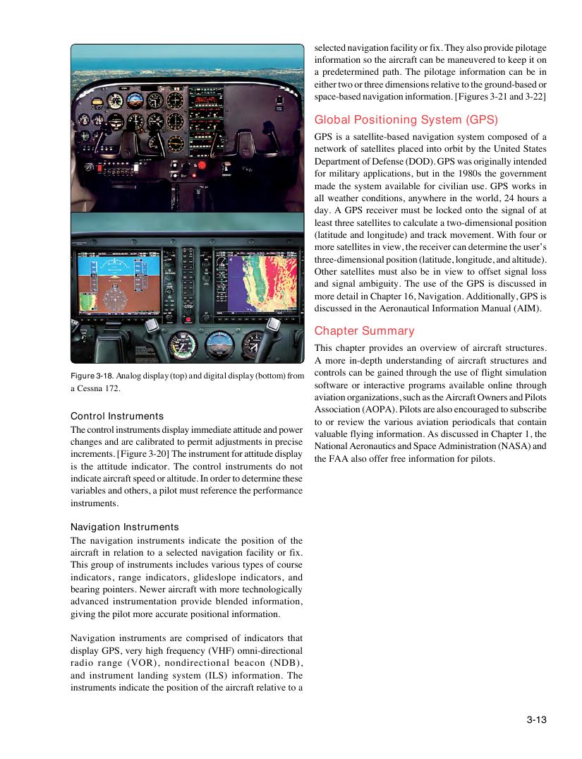
Figure 3-18. Analog display (top) and digital display (bottom) from
software or interactive programs available online through
a Cessna 172.
aviation organizations, such as the Aircraft Owners and Pilots
Association (AOPA). Pilots are also encouraged to subscribe
Control Instruments
to or review the various aviation periodicals that contain
The control instruments display immediate attitude and power
valuable flying information. As discussed in Chapter 1, the
changes and are calibrated to permit adjustments in precise
National Aeronautics and Space Administration (NASA) and
increments. [Figure 3-20] The instrument for attitude display
the FAA also offer free information for pilots.
is the attitude indicator. The control instruments do not
indicate aircraft speed or altitude. In order to determine these
variables and others, a pilot must reference the performance
instruments.
Navigation Instruments
The navigation instruments indicate the position of the
aircraft in relation to a selected navigation facility or fix.
This group of instruments includes various types of course
indicators, range indicators, glideslope indicators, and
bearing pointers. Newer aircraft with more technologically
advanced instrumentation provide blended information,
giving the pilot more accurate positional information.
Navigation instruments are comprised of indicators that
display GPS, very high frequency (VHF) omni-directional
radio range (VOR), nondirectional beacon (NDB),
and instrument landing system (ILS) information. The
instruments indicate the position of the aircraft relative to a
3-13