FAA-H-8083-25C · Source PDF page 379
Airspace
Other Airspace Areas · PHAK page 15-4
Searchable transcription
Restricted areas are charted with an “R” followed by a
number (e.g., R-4401) and are depicted on the en route
chart appropriate for use at the altitude or FL being flown.
[Figure 15-3] Restricted area information can be obtained
on the back of the chart.
Warning Areas
Warning areas are similar in nature to restricted areas;
however, the United States government does not have sole
jurisdiction over the airspace. A warning area is airspace of
defined dimensions, extending from 3 NM outward from
the coast of the United States, containing activity that may
be hazardous to nonparticipating aircraft. The purpose of
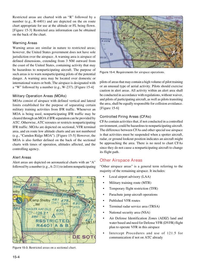
Figure 15-4. Requirements for airspace operations.
such areas is to warn nonparticipating pilots of the potential
danger. A warning area may be located over domestic or
international waters or both. The airspace is designated with pilots of areas that may contain a high volume of pilot training
a “W” followed by a number (e.g., W-237). [Figure 15-4] or an unusual type of aerial activity. Pilots should exercise
caution in alert areas. All activity within an alert area shall
be conducted in accordance with regulations, without waiver,
Military Operation Areas (MOAs)
and pilots of participating aircraft, as well as pilots transiting
MOAs consist of airspace with defined vertical and lateral
the area, shall be equally responsible for collision avoidance.
limits established for the purpose of separating certain
[Figure 15-6]
military training activities from IFR traffic. Whenever an
MOA is being used, nonparticipating IFR traffic may be
Controlled Firing Areas (CFAs)
cleared through an MOA if IFR separation can be provided by
CFAs contain activities that, if not conducted in a controlled
ATC. Otherwise, ATC reroutes or restricts nonparticipating
environment, could be hazardous to nonparticipating aircraft.
IFR traffic. MOAs are depicted on sectional, VFR terminal
The difference between CFAs and other special use airspace
area, and en route low altitude charts and are not numbered
is that activities must be suspended when a spotter aircraft,
(e.g., “Camden Ridge MOA”). [Figure 15-5] However, the
radar, or ground lookout position indicates an aircraft might
MOA is also further defined on the back of the sectional
be approaching the area. There is no need to chart CFAs
charts with times of operation, altitudes affected, and the
since they do not cause a nonparticipating aircraft to change
controlling agency.
its flight path.
Alert Areas
Other Airspace Areas
Alert areas are depicted on aeronautical charts with an “A”
followed by a number (e.g., A-211) to inform nonparticipating “Other airspace areas” is a general term referring to the
majority of the remaining airspace. It includes:
• Local airport advisory (LAA)
• Military training route (MTR)
• Temporary flight restriction (TFR)
• Parachute jump aircraft operations
• Published VFR routes
• Terminal radar service area (TRSA)
• National security area (NSA)
• Air Defense Identification Zones (ADIZ) land and
water based and need for Defense VFR (DVFR) flight
plan to operate VFR in this airspace
• Intercept Procedures and use of 121.5 for
communication if not on ATC already
Figure 15-3. Restricted areas on a sectional chart.
15-4