FAA-H-8083-25C · Source PDF page 419
Navigation
RAIM Capability · PHAK page 16-32
Searchable transcription
55 degrees relative to the equator. The orbital radius (i.e. each type of receiver installation or use must be understood
distance from the center of mass of the earth to the satellite) by the pilot to avoid misusing navigation information. In all
is approximately 26,600 km. cases, VFR pilots should never rely solely on one system
of navigation. GPS navigation must be integrated with
With the baseline satellite constellation, users with a clear other forms of electronic navigation, as well as pilotage
view of the sky have a minimum of four satellites in view. and dead reckoning. Only through the integration of these
It is more likely that a user would see six to eight satellites. techniques can the VFR pilot ensure accuracy in navigation.
The satellites broadcast ranging signals and navigation data Some critical concerns in VFR use of GPS include RAIM
allowing users to measure their pseudoranges in order to capability, database currency, and antenna location.
estimate their position, velocity and time, in a passive, listen-
only mode. The receiver uses data from a minimum of four RAIM Capability
satellites above the mask angle (the lowest angle above the Many VFR GPS receivers and all hand-held units are not
horizon at which a receiver can use a satellite). The exact equipped with RAIM alerting capability. Loss of the required
number of satellites operating at any one particular time number of satellites in view, or the detection of a position
varies depending on the number of satellite outages and error, cannot be displayed to the pilot by such receivers.
operational spares in orbit. For current status of the GPS In receivers with no RAIM capability, no alert would
constellation, please visit http://tycho.usno.navy.mil/gpscurr. be provided to the pilot that the navigation solution had
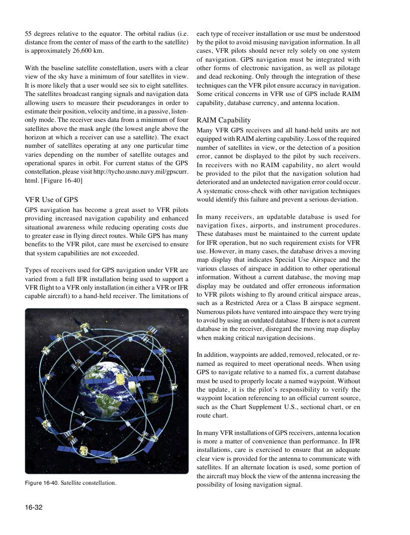
html. [Figure 16-40] deteriorated and an undetected navigation error could occur.
A systematic cross-check with other navigation techniques
VFR Use of GPS would identify this failure and prevent a serious deviation.
GPS navigation has become a great asset to VFR pilots
providing increased navigation capability and enhanced In many receivers, an updatable database is used for
situational awareness while reducing operating costs due navigation fixes, airports, and instrument procedures.
to greater ease in flying direct routes. While GPS has many These databases must be maintained to the current update
benefits to the VFR pilot, care must be exercised to ensure for IFR operation, but no such requirement exists for VFR
that system capabilities are not exceeded. use. However, in many cases, the database drives a moving
map display that indicates Special Use Airspace and the
Types of receivers used for GPS navigation under VFR are various classes of airspace in addition to other operational
varied from a full IFR installation being used to support a information. Without a current database, the moving map
VFR flight to a VFR only installation (in either a VFR or IFR display may be outdated and offer erroneous information
capable aircraft) to a hand-held receiver. The limitations of to VFR pilots wishing to fly around critical airspace areas,
such as a Restricted Area or a Class B airspace segment.
Numerous pilots have ventured into airspace they were trying
to avoid by using an outdated database. If there is not a current
database in the receiver, disregard the moving map display
when making critical navigation decisions.
In addition, waypoints are added, removed, relocated, or re-
named as required to meet operational needs. When using
GPS to navigate relative to a named fix, a current database
must be used to properly locate a named waypoint. Without
the update, it is the pilot’s responsibility to verify the
waypoint location referencing to an official current source,
such as the Chart Supplement U.S., sectional chart, or en
route chart.
In many VFR installations of GPS receivers, antenna location
is more a matter of convenience than performance. In IFR
installations, care is exercised to ensure that an adequate
clear view is provided for the antenna to communicate with
satellites. If an alternate location is used, some portion of
the aircraft may block the view of the antenna increasing the
Figure 16-40. Satellite constellation. possibility of losing navigation signal.
16-32