FAA-H-8083-25C · Source PDF page 313
Aviation Weather Services
Observations · PHAK page 13-3
Searchable transcription
severe weather, defense, marine, public weather and
environmental monitoring. The information is down linked
either via Very High Frequency (VHF) communications
through the Aircraft Communications Addressing and
Reporting System (ACARS) or via satellite link through the
Aircraft to Satellite Data Acquisition and Relay (ASDAR).
The Meteorological Data Collection and Reporting System
(MDCRS) is an automated airborne weather observation
program that is used in the U.S. This program collects and
disseminates real-time upper-air weather observations from
participating airlines. The weather elements are down linked
via ACARS and are managed by Aeronautical Radio, Inc.
(ARINC) who then forwards them in Binary Universal Form
for the Representation of Meteorological Data (BUFR)
format to the NWS and in raw data form to the Earth Science
Research Laboratory (ESRL) and the participating airline.
More than 1,500 aircraft report wind and temperature data
with some of these same aircraft also providing turbulence
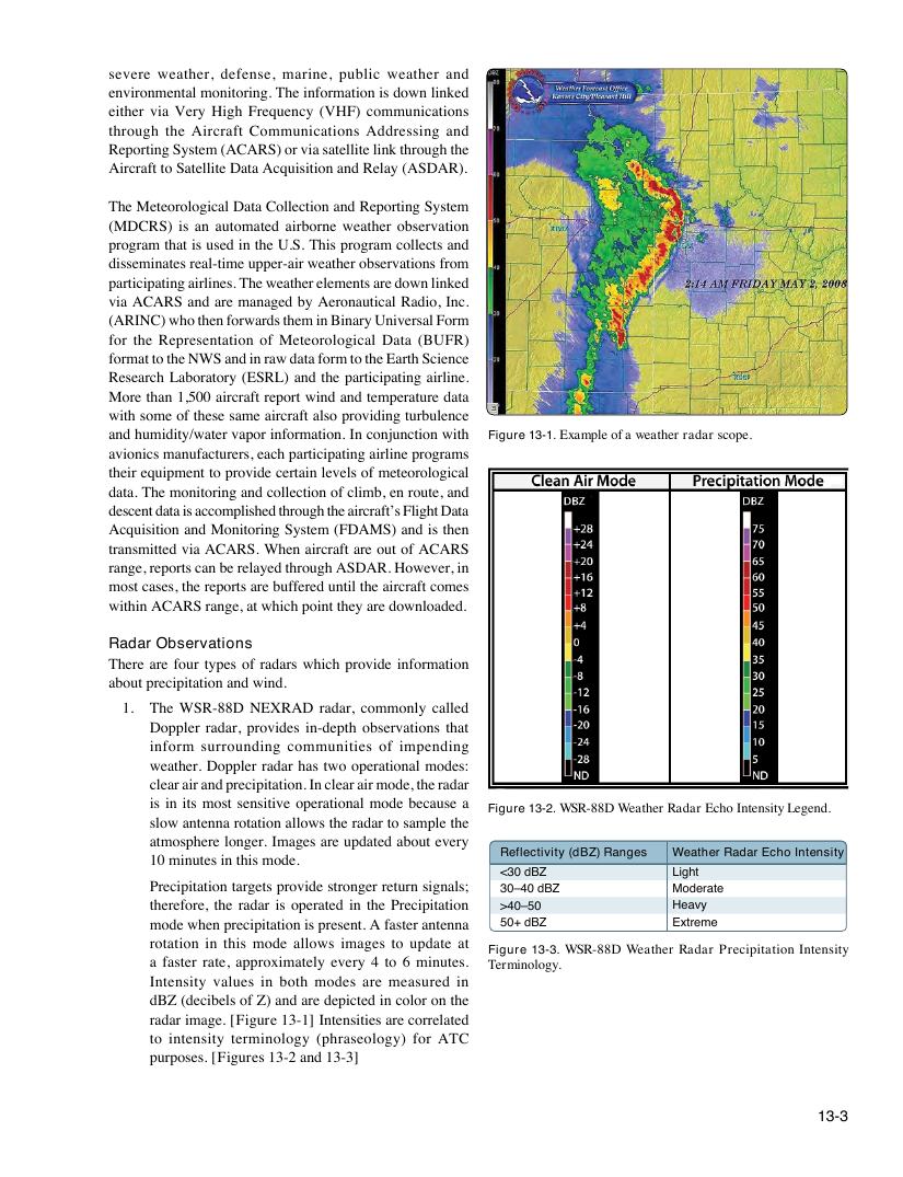
and humidity/water vapor information. In conjunction with Figure 13-1. Example of a weather radar scope.
avionics manufacturers, each participating airline programs
their equipment to provide certain levels of meteorological
data. The monitoring and collection of climb, en route, and
descent data is accomplished through the aircraft’s Flight Data
Acquisition and Monitoring System (FDAMS) and is then
transmitted via ACARS. When aircraft are out of ACARS
range, reports can be relayed through ASDAR. However, in
most cases, the reports are buffered until the aircraft comes
within ACARS range, at which point they are downloaded.
Radar Observations
There are four types of radars which provide information
about precipitation and wind.
1. The WSR-88D NEXRAD radar, commonly called
Doppler radar, provides in-depth observations that
inform surrounding communities of impending
weather. Doppler radar has two operational modes:
clear air and precipitation. In clear air mode, the radar
is in its most sensitive operational mode because a
Figure 13-2. WSR-88D Weather Radar Echo Intensity Legend.
slow antenna rotation allows the radar to sample the
atmosphere longer. Images are updated about every
Reflectivity (dBZ) Ranges Weather Radar Echo Intensity
10 minutes in this mode.
<30 dBZ Light
Precipitation targets provide stronger return signals; 30–40 dBZ Moderate
therefore, the radar is operated in the Precipitation >40–50 Heavy
mode when precipitation is present. A faster antenna 50+ dBZ Extreme
rotation in this mode allows images to update at
Figure 13-3. WSR-88D Weather Radar Precipitation Intensity
a faster rate, approximately every 4 to 6 minutes. Terminology.
Intensity values in both modes are measured in
dBZ (decibels of Z) and are depicted in color on the
radar image. [Figure 13-1] Intensities are correlated
to intensity terminology (phraseology) for ATC
purposes. [Figures 13-2 and 13-3]
13-3