FAA-H-8083-25C · Source PDF page 392
Navigation
Latitude and Longitude (Meridians and · PHAK page 16-5
Searchable transcription
Pacific standard time Mountain standard time Central standard time Eastern standard time
75°
120°
105°
90°
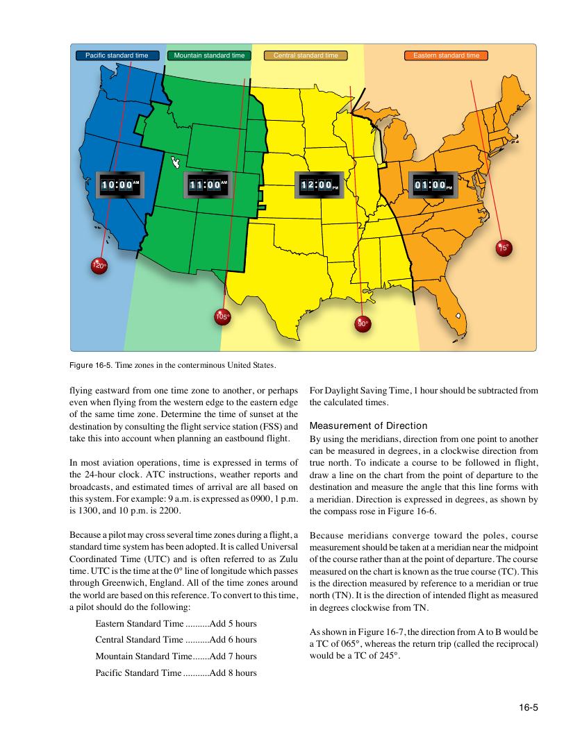
Figure 16-5. Time zones in the conterminous United States.
flying eastward from one time zone to another, or perhaps For Daylight Saving Time, 1 hour should be subtracted from
even when flying from the western edge to the eastern edge the calculated times.
of the same time zone. Determine the time of sunset at the
destination by consulting the flight service station (FSS) and Measurement of Direction
take this into account when planning an eastbound flight. By using the meridians, direction from one point to another
can be measured in degrees, in a clockwise direction from
In most aviation operations, time is expressed in terms of true north. To indicate a course to be followed in flight,
the 24-hour clock. ATC instructions, weather reports and draw a line on the chart from the point of departure to the
broadcasts, and estimated times of arrival are all based on destination and measure the angle that this line forms with
this system. For example: 9 a.m. is expressed as 0900, 1 p.m. a meridian. Direction is expressed in degrees, as shown by
is 1300, and 10 p.m. is 2200. the compass rose in Figure 16-6.
Because a pilot may cross several time zones during a flight, a Because meridians converge toward the poles, course
standard time system has been adopted. It is called Universal measurement should be taken at a meridian near the midpoint
Coordinated Time (UTC) and is often referred to as Zulu of the course rather than at the point of departure. The course
time. UTC is the time at the 0° line of longitude which passes measured on the chart is known as the true course (TC). This
through Greenwich, England. All of the time zones around is the direction measured by reference to a meridian or true
the world are based on this reference. To convert to this time, north (TN). It is the direction of intended flight as measured
a pilot should do the following: in degrees clockwise from TN.
Eastern Standard Time ..........Add 5 hours
As shown in Figure 16-7, the direction from A to B would be
Central Standard Time ..........Add 6 hours
a TC of 065°, whereas the return trip (called the reciprocal)
Mountain Standard Time.......Add 7 hours would be a TC of 245°.
Pacific Standard Time ...........Add 8 hours
16-5