FAA-H-8083-25C · Source PDF page 403
Navigation
Step 2 · PHAK page 16-16
Searchable transcription
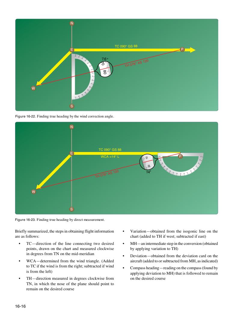
Figure 16-22. Finding true heading by the wind correction angle.
N
TC 090° GS 88
E
WCA =14° L 0
1
071
061
P
02
01
TH
076° AS 120 1 4
0 2
° 051
051
041
031
021 011 001 09 08 07 06
05
04
03
041
031
W 021
011 001 09 08 07
S
Figure 16-23. Finding true heading by direct measurement.
16-16
90
N
TC 090° GS 88
E P
10 20 30
40 50
60
TH 076° AS 120
70
80
001
011
W
021
071 061
051
041
031
S
90
10
20
30
40
50
60
76°
7 0
8
0
1
0 0
1 1
0
021
031
Briefly summarized, the steps in obtaining flight information • Variation—obtained from the isogonic line on the
are as follows: chart (added to TH if west; subtracted if east)
• TC—direction of the line connecting two desired • MH—an intermediate step in the conversion (obtained
points, drawn on the chart and measured clockwise by applying variation to TH)
in degrees from TN on the mid-meridian
• Deviation—obtained from the deviation card on the
• WCA—determined from the wind triangle. (Added aircraft (added to or subtracted from MH, as indicated)
to TC if the wind is from the right; subtracted if wind
• Compass heading—reading on the compass (found by
is from the left)
applying deviation to MH) that is followed to remain
• TH—direction measured in degrees clockwise from on the desired course
TN, in which the nose of the plane should point to
remain on the desired course