FAA-H-8083-25C · Source PDF page 302
Weather Theory
Fronts · PHAK page 12-18
Searchable transcription
over warm tropical waters like the Caribbean Sea and bring There are four types of fronts that are named according to the
warm, moist air. As the air mass moves from its source region temperature of the advancing air relative to the temperature
and passes over land or water, the air mass is subjected to of the air it is replacing: [Figure 12-24]
the varying conditions of the land or water which modify the
• Warm
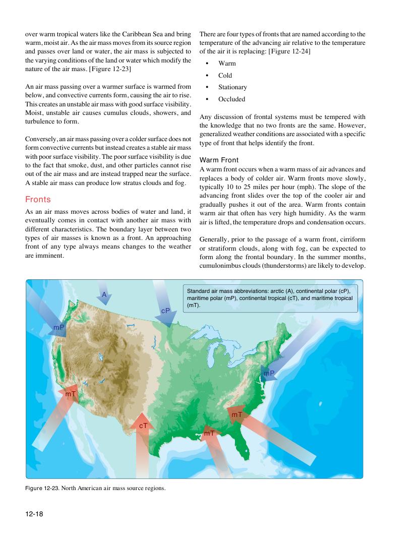
nature of the air mass. [Figure 12-23]
• Cold
An air mass passing over a warmer surface is warmed from • Stationary
below, and convective currents form, causing the air to rise.
• Occluded
This creates an unstable air mass with good surface visibility.
Moist, unstable air causes cumulus clouds, showers, and
Any discussion of frontal systems must be tempered with
turbulence to form.
the knowledge that no two fronts are the same. However,
generalized weather conditions are associated with a specific
Conversely, an air mass passing over a colder surface does not
type of front that helps identify the front.
form convective currents but instead creates a stable air mass
with poor surface visibility. The poor surface visibility is due
Warm Front
to the fact that smoke, dust, and other particles cannot rise
A warm front occurs when a warm mass of air advances and
out of the air mass and are instead trapped near the surface.
replaces a body of colder air. Warm fronts move slowly,
A stable air mass can produce low stratus clouds and fog.
typically 10 to 25 miles per hour (mph). The slope of the
advancing front slides over the top of the cooler air and
Fronts
gradually pushes it out of the area. Warm fronts contain
As an air mass moves across bodies of water and land, it warm air that often has very high humidity. As the warm
eventually comes in contact with another air mass with air is lifted, the temperature drops and condensation occurs.
different characteristics. The boundary layer between two
types of air masses is known as a front. An approaching Generally, prior to the passage of a warm front, cirriform
front of any type always means changes to the weather or stratiform clouds, along with fog, can be expected to
are imminent. form along the frontal boundary. In the summer months,
cumulonimbus clouds (thunderstorms) are likely to develop.
Standard air mass abbreviations: arctic (A), continental polar (cP),
A
maritime polar (mP), continental tropical (cT), and maritime tropical
(mT).
cP
mP
mP
mT
mT
cT
mT
Figure 12-23. North American air mass source regions.
12-18